As autonomy scales and AI moves to the edge, precision becomes paramount. GEODNET’s decentralized RTK network delivers the centimeter-level accuracy that enables drones not just to fly—but to think—in real-world environments.
As the use of drones continues to expand across industries, the demand for precision and reliability in autonomous flight has never been higher. Whether delivering packages to doorsteps, performing remote inspections or treating crops with pinpoint accuracy, drones must hover and navigate with confidence. This is especially true for autonomous and remotely managed systems—such as drone-in-a-box platforms—where there’s no human pilot on-site to make manual corrections.
In these use cases, Real-Time Kinematic (RTK) corrections—delivered via the GEODNET network—are a critical enabler of performance and safety.
GETTING PRECISE WITH RTK: WHY GNSS ALONE ISN’T ENOUGH
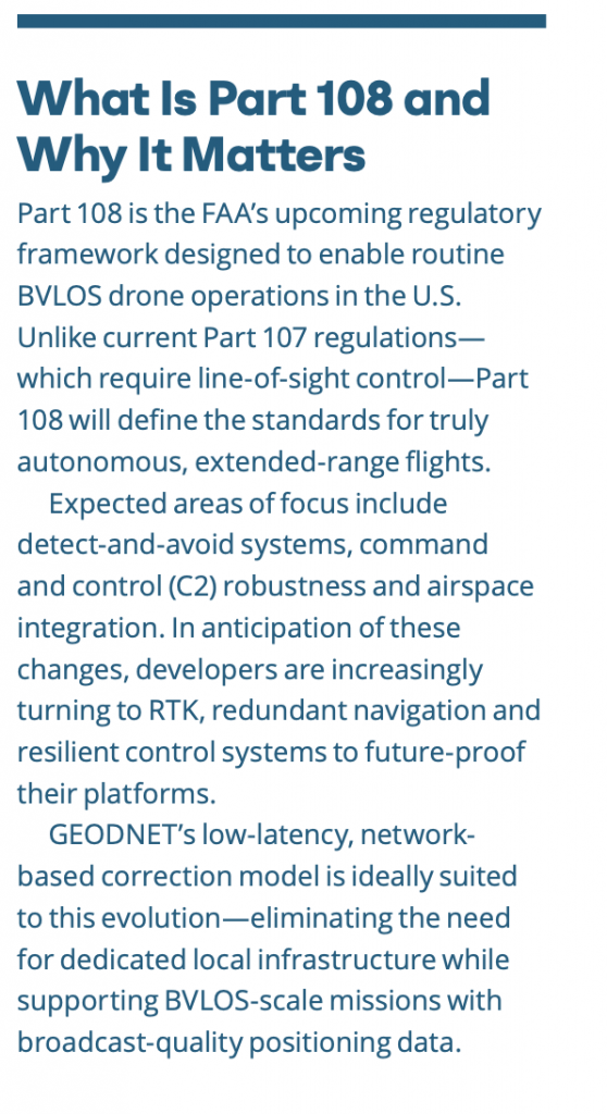
Most drones today rely on standard GNSS for navigation and hover control. While sufficient for recreational or low-risk applications, meter-level inaccuracies can degrade performance during waypoint transitions, precision holds or flights near infrastructure. These inaccuracies also erode trust in the drone’s autonomy, a critical issue as operators and regulators move toward BVLOS operations under anticipated FAA Part 108 rules.
GEODNET is tackling this challenge head-on. As the world’s largest decentralized network of GNSS reference stations, GEODNET provides centimeter-level accuracy and low-latency RTK corrections via a globally distributed, blockchain-secured infrastructure. The result: autonomous drones that are no longer “guessing” their location but operating with near-human spatial confidence.
“Imagine if you could memorize where everything is in the grocery store to centimeter accuracy,” GEODNET Founder and CEO Mike Horton said. “You’d be hyper-intelligent. You’d be navigating the physical world with far more precision than the average human. That’s what RTK does for autonomous systems—it enables them to be truly smart in the physical world.”
HOVERING: THE LITMUS TEST FOR PRECISION
If precise navigation is the goal, stable hover is the proving ground. Horton emphasized that hover accuracy—especially in windy or feature-poor environments—is one of the most demanding control problems drones face.
“RTK gives you a 15X improvement over standard GNSS and a 3X improvement over vision positioning in hover stability,” he said. “And in conditions like moderate wind or lowlight—where vision systems struggle—RTK still performs. It’s absolute positioning, not relative.”
This makes RTK especially vital for autonomous platforms that must operate in challenging conditions: windy urban canyons, sun-bleached agricultural fields and low-contrast industrial zones.
RTK IN ACTION: KEY USE CASES
DRONE DELIVERY & DRONE-IN-A-BOX SYSTEMS
Drone delivery and autonomous drone-in-a-box deployments are among the most demanding applications in terms of positional accuracy. These systems must launch, navigate and land entirely without human input—often in tight, GPS-contested environments.
“Delivery systems need to solve both sides of the equation—outbound delivery and precise return-to-base operations.”
Horton explained, “They have to precisely deliver a payload, but they also need to land themselves back at the base station or charging dock. That’s not a trivial problem, especially when you’re dealing with windy conditions, rooftop landing zones or a constrained takeoff bay.”
For commercial drone networks scaling up to dozens or hundreds of daily flights, the ability to deliver consistently and safely at scale depends on this kind of repeatable accuracy—and on correction networks like GEODNET that eliminate the need for site-specific RTK stations.
MAPPING & INSPECTION
For drone-based mapping and industrial inspection, RTK unlocks two critical capabilities: enhanced photogrammetric accuracy and close-proximity flight.
“Everyone talks about the 3D digital twin, reality capture, centimeter-level models of the world,” Horton said. “But to do that well, you’ve got to fly consistent patterns, hit your overlap and stay steady. RTK gets you that.”
GEODNET’s corrections ensure that even in GNSS-constrained environments—dense urban centers, under bridges, or near reflective surfaces—drone flight paths remain stable and repeatable.
“And then there’s the close-in work,” Horton added. “We’re seeing growing demand for drones inspecting skyscraper facades, scanning for debris that might fall and injure someone. These drones need to operate within a meter of the structure. Vision systems often break down in these settings, but RTK doesn’t. It gives you the precision to safely fly close without risk.”
Use cases such as facade inspections, utility tower surveys and even drone-based window washing rely on this positional accuracy to avoid collisions and reduce operational risk.
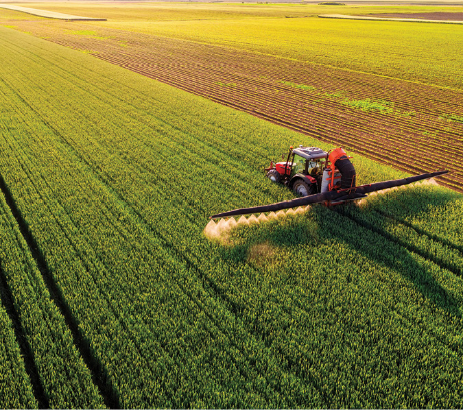
PRECISION AGRICULTURE
In the field, centimeter-level positioning translates directly into agricultural efficiency and environmental stewardship.
Spraying drones equipped with RTK can fly consistent grid patterns at fixed altitudes, minimizing overlap and reducing chemical waste. With inputs like fertilizers and fungicides growing more expensive—and runoff regulations tightening—precision is more than a convenience; it’s a requirement.
“You see it at every ag show,” Horton noted. “These spray drones are everywhere. But the overlap issue is huge—5% excess spray over hundreds of acres adds up to thousands of dollars, not to mention potential crop damage or runoff violations. RTK is what makes that control possible.”
By improving hover and track fidelity, GEODNET-powered RTK enables smarter, safer and more efficient autonomous agriculture.
RTK + AI = PHYSICAL INTELLIGENCE
One of the most compelling aspects of GEODNET’s value lies in its intersection with AI-powered autonomy. As drones become smarter—integrating embedded processors, onboard neural networks and even lightweight versions of large language models (LLMs)—the accuracy of their physical navigation becomes even more critical.
“There’s this idea of ‘Physical AI’ or ‘embodied cognition,’” Horton said. “It’s not enough for an AI to just consume text on the internet. It has to interact with the world to really learn. And to do that well, it has to know exactly where it is.”
LLMs, typically associated with natural language tasks, are now being adapted and distilled into compact, domain-specific models that can run on edge hardware. These models—especially when paired with vision, LiDAR and IMU data—enable a new generation of drones to perform context-aware decision-making and navigate unpredictable environments autonomously.
In that sense, RTK becomes more than a positioning system. It becomes a prerequisite for intelligent behavior—allowing AI agents to build high-fidelity spatial models of their environment through real-world experience.
“When a drone can navigate a warehouse or a cornfield with centimeter accuracy, it’s building a map that’s orders of magnitude more useful than what a human could create,” Horton said. “That’s what enables true intelligence—not just seeing but remembering and acting with spatial context.”
A SMARTER SKY
From precision agriculture to autonomous delivery and inspection, GEODNET is shaping the next frontier of unmanned flight. By delivering high-integrity, low-latency corrections through a decentralized, scalable infrastructure, it removes a major barrier to safe, efficient and intelligent drone operations.
As AI takes a more central role in autonomy, RTK will only become more important—serving not just as a navigational aid, but as the key that unlocks embodied intelligence in machines that must learn, adapt, and act in the real world.
“The smarter these drones get,” Horton said, “the more important it is that they know exactly where they are.”