Mosaic and Movella have announced a partnership that combines Mosaic’s mobile mapping cameras with Movella’s inertial sensor solutions. This collaboration aims to improve GIS platform integration and enable more precise 3D reconstruction in mapping projects.
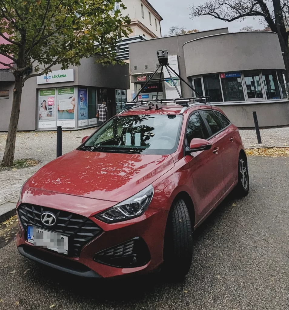
The integration utilizes precise IMU data from Movella’s XVN sensors, directly connected to the vehicle’s OBD port to enhance positioning accuracy. This development represents an advancement in mobile mapping by facilitating centimeter-level accuracy and high-quality imagery without the need for extensive post-processing.
Mosaic’s Mosaic 51 and Mosaic X camera systems are designed for capturing high-resolution, 360º street view imagery. These systems have been recognized for their ability to operate in challenging environments, capturing up to 12K resolution imagery. The collaboration with Movella extends these capabilities, offering comprehensive mapping at highway speeds and superior performance in extreme conditions.
Movella’s Vision Navigator introduces accurate 3D position, velocity, and orientation tracking in various environments, supported by Visual Inertial Odometry technology. This allows for more accurate data collection in areas where GPS signals are weak or unavailable.
Jeffrey Martin, CEO of Mosaic, noted the improvements in their 3D scanning and photogrammetry workflow due to the integration, achieving higher accuracy. Rick Huiskamp, Account Executive at Movella, emphasized that the partnership aims to set new standards for mapping and 3D reconstruction accuracy and efficiency, potentially leading to new applications across different industries.