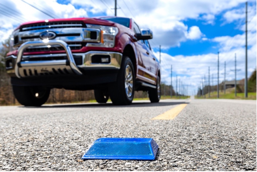
Autonomous vehicles may one day rely on high-tech versions of the pavement markers currently used to help drivers identify lanes to get key data about roads, a recent study finds.
Self-driving vehicles rely on multiple sensors to supply data that onboard computers use to analyze their environments. Detecting lanes is vital, but can prove tricky for these computers.
In the new study, the research team at Oak Ridge National Laboratory in Tennessee and Western Michigan University in Kalamazoo explored how low-cost, low-power sensors in pavement markers could help supply data to identify lanes. Microchips inside the markers can transmit information to passing cars about the road shape. They are effective even when vehicle cameras or LiDAR sensors are unreliable because of fog, snow, glare and other obstructions.
“We are working to make autonomous driving features accurate and safe in more remote areas,” Oak Ridge National Laboratory researcher Ali Ekti said in a statement. “And we are doing it by converting a dummy piece of infrastructure into something with many more uses.”
The researchers experimented to find the best combination of transceiver, battery and antenna for the sensor package inside standard road markers, as well as those that are designed to withstand snowplows. They next used a communications protocol that involves hopping across a particular radio frequency spectrum up to 50 times a second.
“It’s hard to detect, works well against interference, is low cost and doesn’t consume a lot of power,” Ekti said in a statement. Adjustments to the equipment could ensure the device’s battery would last for the same replacement cycle as regular pavement markers, typically a year.
The scientists field-tested the sensor platform in a variety of weather conditions and in a remote national park in Montana with no wireless access. They found that it transmits more than five times beyond the original 100-meter goal.
“It’s amazing how far it can transmit — over hills, in snow. It’s a big deal,” Zachary Asher, assistant professor of mechanical and aerospace engineering and director of Western Michigan University’s Energy Efficient and Autonomous Vehicles Lab, said in a statement. “Every step of the way, we’re surprised at how well this technology is working, and we’re finding some really cool ways it could be integrated.”
In addition, the scientists created algorithms that use the GPS coordinates of the lane markers to reconstruct an image of the drivable area. One algorithm is embedded in a microchip inside the pavement marker, while a decoding algorithm is incorporated into an autonomous vehicle’s software.
This strategy not only provides autonomous vehicles more accurate information about their driving environments, but it also shifts some of the processing load from the car’s software onto infrastructure. This saves electric vehicle battery power, extending driving range to promote wider electric vehicle adoption. Compared with a leading camera and LiDAR-based autonomous driving technology, the chip-enabled pavement markers can reduce navigational power consumption by up to 90%, the researchers noted.
The sensors could also signal temporary lane shifts or closures in construction zones when high-definition maps might be out of date. Marker sensors could eventually convey information about temperature, humidity and traffic volume, Ekti said.
The project team plans to build a smaller microchip for the markers as a substitute for more expensive off-the-shelf products. They noted the technology has potential for use with not only tomorrow’s self-driving vehicles, but also today’s common advanced driver assistance systems (ADAS), such as lane assist.
The researchers are planning road demonstrations for stakeholders including the Tennessee and Michigan departments of transportation. These government agencies decide which technologies are implemented in infrastructure, so their involvement in the development process is critical, Asher said.
The scientists detailed their findings in a recent issue of the journal IEEE Sensors.

