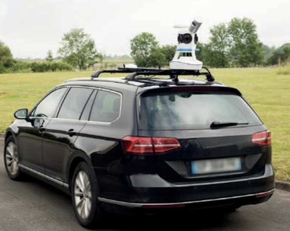
Photo: courtesy of Viametris
Described as more design-orientated and compact, vMS3D second-generation version of the 3D mobile vehicle scanner has been fully redesigned. Viametris’ system has been simplified considerably in both electronic and ergonomic terms to make it more robust and stable in adverse conditions and challenging environments, according to the manufacturer.
Despite being lighter, the second generation offers all the same technological capacities as its predecessor, but is simpler to use and can be mounted on a vehicle in just minutes.
The system component (including the sensors) and the element to fix the device to the vehicle (the frame) previously formed one unit, but are now separated. It has been completely redesigned to be much lighter (9 kilograms) and more compact.
The mechanism to fix the scanner to the vehicle, which formed part of the system in the first-generation version, has been entirely transformed. A completely rigid metal frame, fixed onto two roof bars, now holds the system, which fits into a dedicated compartment in seconds. As the frame is totally rigid, this limits all vibrations between the system and the vehicle and thus prevents any strain on the mechanics during acquisition.
The second auxiliary antenna which measures the heading by satellite, is discreet and non-removable, and fixed directly to the vehicle chassis. This new design is said to make it easier to mount and use the system, and only takes one person to mount the system; this can be done in under three minutes in a configuration where the frame remains permanently fixed to a dedicated vehicle. Furthermore, the alignment phase takes place the first time the system is mounted and does not need to be repeated. This saves valuable time each start.
Technological Features
The vMS3D comprises a new set of components designed to be more robust and stable in difficult conditions.
- The integrated connectors are next-generation and embedded-grade,
- The control box for power supply and communication with the tablet has been moved inside the vehicle to offer increased comfort to the user
- Receiver: GPS+GLONASS+BEIDOU+GALILEO / 448 channels – L1/L2, B1/B2, E1/E5B, RAW
The company has developed a unique, hybrid approach which brings together IMU (Inertial Measurement Unit), GNSS and SLAM (Simultaneous Localisation and Mapping) to respond to all the constraints that might skew a trajectory.
- The IMU can independently calculate a trajectory, but over a short period.
- The satellite positioning has long-distance coherence, but the slightest obstacle (tunnels, urban canyons, trees, etc.) disturbs the signal. In the event of outage, the IMU filters the signals for a limited time, but the position deviation increases by time.
- The SLAM is autonomous, using keypoints in the environment. However, the deviation increases by distance.

